Lilongwe, Malawi: In a nation where nearly 80% of the population relies on smallholder farming, the challenges are immense. Malawi’s farmers, predominantly cultivating maize on plots averaging less than two hectares, face a relentless struggle against dwindling resources, climate change, and a persistent yield gap. However, a pioneering non-profit organization, Kusamala Institute of Agriculture and Ecology, is harnessing the power of Geographic Information Systems (GIS) to map a path towards sustainable agriculture and improved livelihoods.
The landscape is stark: depleted soil, deforestation, and a reliance on unpredictable rainfall create a precarious existence for these farmers. With limited access to technology and financial services, they struggle to maximize their yields, often producing just enough to feed their families. This precarious situation threatens both their well-being and the environment.
Kusamala, with support from the Esri Conservation Program and the Scottish government, is deploying GIS technology to implement and evaluate Climate-Smart Agriculture (CSA) strategies. Their ambitious project aims to reach 1,500 households in the Dowa and Lilongwe districts, ultimately benefiting 7,500 individuals.
One key strategy is the promotion of the indigenous Faidherbia albida tree, locally known as the “magic tree.” This remarkable species enriches the soil with nitrogen, sequesters carbon, provides livestock fodder, and offers shade during the dry season. GIS plays a crucial role in mapping and analyzing these landscape-level interventions, ensuring their effectiveness.
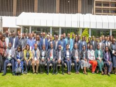
Kusamala’s GIS-driven approach extends beyond individual farms. They’ve facilitated collaborative workshops with over 20 organizations, including government agencies and community groups, to coordinate efforts and avoid duplication. Using ArcMap, they mapped catchment areas, revealing areas of overlap and gaps in service delivery. This collaborative approach ensures resources are targeted effectively, maximizing social and environmental impact.
“Who is doing what and where?” became the central question, driving a participatory mapping process that illuminated the need for coordinated action. This collaborative mapping revealed that many organizations were working in the same areas, while other areas were neglected.
The organization also utilized Collector for ArcGIS to gather GPS data on farmers’ fields, revealing the strategic scattering of plots as a risk mitigation strategy. While this practice minimizes the impact of localized disasters, it also reduces overall yields. GIS analysis allows researchers to understand these complex spatial relationships and tailor CSA interventions accordingly.
The impact of CSA training is being rigorously evaluated using GPS data and participatory video. Farmers’ perceptions of well-being are linked to spatial data, providing a visual representation of the project’s success. “GIS will help us understand the natural and social resources we have in Dowa and Lilongwe districts and how we can best manage them,” says Chisomo Kamchacha, a monitoring and evaluation specialist at Kusamala.
Kusamala’s innovative use of GIS, coupled with satellite imagery, is establishing the organization as a hub for research and development in Malawi. Their work provides a powerful example of how geospatial technology can be deployed to address complex challenges in the developing world, offering a blueprint for scalable and replicable solutions.